
FREE FIELD GUIDE / NAVIGATION / ORIGINAL LEARNING WORKSHEET
Practice reading a topographic map at home
Learn what the legend and elevation information say before using a map to make decisions outdoors.
Identify the map before interpreting it
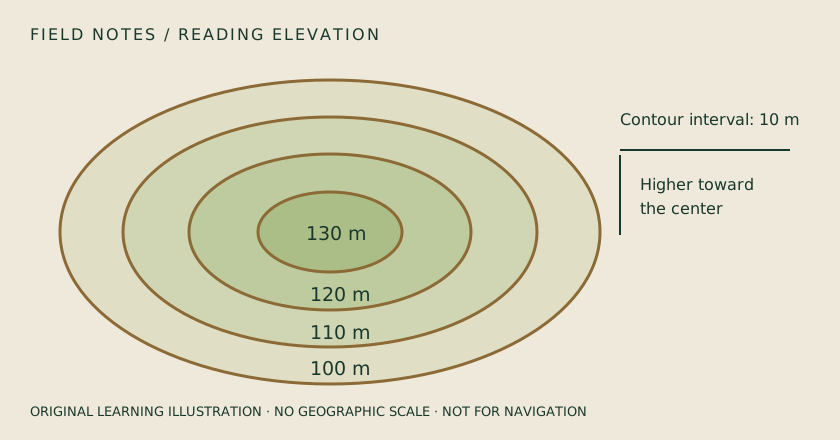
Write down the map's name, publisher, edition and scale. Find its legend and the explanation of the elevation information. USGS describes elevation contours as lines joining points at the same elevation; the reference level and units matter. Different maps can use different scales, symbols and contour intervals. Do not assume that a familiar-looking background uses the same conventions as a previous map. This desk exercise is an introduction to reading information, not a substitute for field navigation training or a determination that a route is safe for your abilities and equipment.
Choose a familiar place for the first exercise
Use an area you already know from an ordinary safe visit or a clearly identified public viewpoint. Find the starting location, a recognizable road and a prominent landform. Compare the labels and terrain representation without inventing explanations for features you cannot identify. Keep a separate list of questions for a qualified instructor or a reliable map reference. Familiarity helps expose a mistaken interpretation, but do not treat memory as more accurate than every dated source. The purpose is to understand how the map represents the place and where its information is incomplete.
Read elevation as information, not decoration
Locate labeled elevation lines or values and the stated interval or units. Work through a small example using the map's own legend. Notice that terrain information communicates changes in the land surface that a flat road diagram may omit. Do not estimate the safety of a slope from screen shading alone. A rendered three-dimensional view can help explain shape, but its appearance depends on display settings and available data. Record which map layer you used so another person can repeat the exercise. If the data or legend is missing, mark the interpretation as uncertain.
Keep map distance separate from travel effort
Use the map's scale to explore a simple distance between known points, following its instructions. A straight-line distance and the length of a road or trail are different measurements. Neither by itself determines travel time, accessibility, legal access or safe passage. Weather, terrain, closures, fatigue and individual needs can change a practical plan. Do not turn an introductory exercise into a route recommendation. Record the measurement method and the assumptions you used. Ask what additional information would be needed before that number could support a real journey.
Compare sources without expecting identical views
Look at a road view, an aerial view and the topographic information for the same area if those sources are available. Record their dates and coverage limits. Aerial imagery may help recognize visible features at its capture date, while a topographic representation emphasizes different information. Missing detail in one view does not prove a feature is absent from the ground. Enlarging an image is not the same as obtaining a newer or higher-detail source. Keep the differences visible in your notes rather than merging them into one unsupported claim about present conditions.
Finish with a teach-back and a training plan
Explain the legend, scale and elevation information to another learner using the selected map. Ask them to identify which details are published, which are your observations and which remain uncertain. Keep a short record of mistakes corrected during the exercise. If you plan to travel beyond familiar maintained routes, obtain appropriate navigation training and practice in safe conditions with suitable supervision. Carry the relevant paper references and follow local access rules. A successful desk exercise establishes that you understand some map information, not that the software can guide you safely through every outdoor situation.
Map-reading practice sheet
Map / publisher / edition: __________________ Scale / elevation units / interval: __________________ Familiar feature identified: __________________ Distance exercise / method / assumptions: __________________ Road, aerial and terrain source dates: __________________ Uncertain symbols or interpretations: __________________ Teach-back correction: __________________ Training or local-access information needed: __________________